
Table Mountain
Cableway or footpath, and how to pick your day. The mountain is weather-dependent, occasionally closed, and worth building flexibility around.
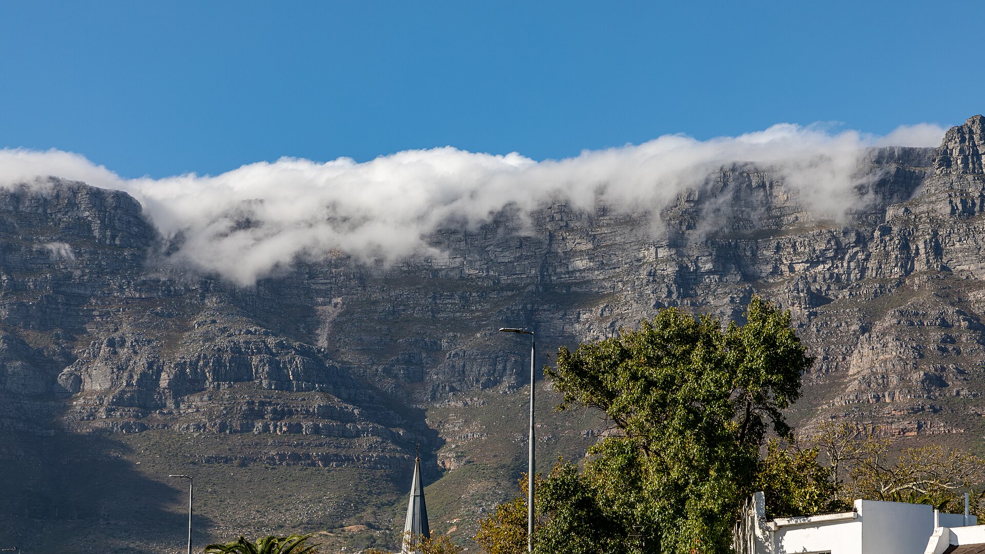
Hero image: Cape Town (ZA), Table Mountain — 2024 — 3437.jpg by Dietmar Rabich, CC BY-SA 4.0, via Wikimedia Commons.
Table Mountain is the flat-topped sandstone massif that defines Cape Town, rising directly behind the city centre and forming the northern end of Table Mountain National Park. Its highest point, Maclear’s Beacon, is given as roughly 1,085 m by the Cableway operator and 1,088 m by SANParks — a small discrepancy between two official bodies, so treat any single precise figure with suspicion.
Two things matter more than anything else when planning a visit. The first is that the mountain makes its own weather and the Cableway closes in high wind and poor visibility, sometimes for days at a stretch. The second is that going up on foot is a real hike, not a stroll, and people get into serious trouble on it every year. Plan for both and it is one of the great half-days in Africa.
Table Mountain at a glance
- Managing authority
- SANParks (Table Mountain National Park); the Cableway is run separately by the Table Mountain Aerial Cableway Company
- Height
- Approximately 1,085–1,088 m at Maclear’s Beacon, depending on the official source
- Ways up
- Aerial cableway, or hiking routes including Platteklip Gorge and Skeleton Gorge
- Time needed
- Two to four hours for a cableway visit; four to seven hours for a hike up and cable car down
- Weather
- Closes in strong wind or low cloud. Check status on the day, not in advance
- Annual closure
- The Cableway closes for annual maintenance in winter. In 2026 the operator scheduled 27 July to 9 August. The length has varied in past years, so check the Cableway’s own site for the current year
- Designations
- One of the New7Wonders of Nature (official May 2012); part of the Cape Floral Region Protected Areas UNESCO World Heritage Site
Where to stay and what to book for Table Mountain
Tickets, hikes and guided routes up the mountain, and hotels close enough to walk from.
Places to stay
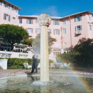
Mount Nelson, A Belmond Hotel, Gardens
A 196-room hotel opened in 1899, set in nine acres of gardens below Table Mountain in Gardens.
View Property DetailsThe Westin Cape Town, Foreshore
A tall, full-service Foreshore hotel joined to the CTICC, walking distance to both the city and the Waterfront.
View Property DetailsTaj Cape Town, City Centre
A heritage conversion of the old Reserve Bank on Wale Street, at the top of the city centre.
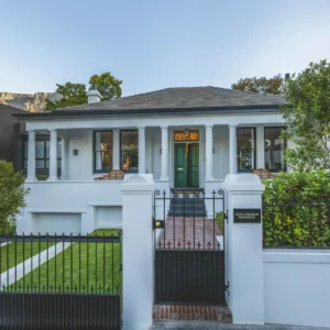
View Property DetailsCape Cadogan Boutique Hotel, Gardens
A restored heritage house on a quiet Gardens street, a few minutes from Kloof Street on foot.
View Property Details


Browse all Cape Town accommodation
Tours and experiences
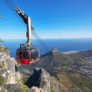
Cape Town: Table Mountain Cable Car Ticket
The cableway ticket itself — useful for skipping the payment queue, not the weather.
View Tour DetailsCape Town: Table Mountain Hike with an Experienced Guide
A guide, a route chosen for the day’s weather, and the mountain explained on the way up.
View Tour DetailsCape Town: Table Mountain Cable Car, Hop-On Hop-Off Bus Tour
The open-top bus network combined with a cableway ticket — the standard first-day package.
View Tour DetailsCape Town: Table Mountain, Kirstenbosch Botanic Garden Tour
The mountain from above and from below — the cableway paired with the botanical garden on its eastern slopes.
View Tour Details

In this Table Mountain guide
Why visit Table Mountain
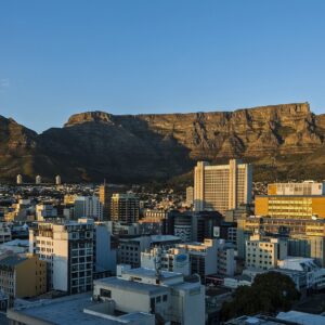
The view is the obvious reason: from the plateau you can see the City Bowl, Robben Island, the Atlantic Seaboard and, on a clear day, right down the Peninsula. But the mountain is also a botanical site of global significance. It sits within the Cape Floral Region, and SANParks records over 2,000 plant species inside Table Mountain National Park, including more than 700 threatened plants and the endemic Table Mountain ghost frog.
It is worth being precise about the UNESCO status, because it is widely misreported. Table Mountain is not inscribed as a World Heritage Site in its own right. The Cape Floral Region Protected Areas is a serial property of thirteen protected-area clusters, inscribed in 2004 and extended in 2015, and Table Mountain National Park is one of those thirteen.
The Aerial Cableway
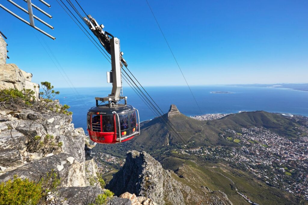
The cableway runs from the Lower Station on Tafelberg Road to the top of the front face. The cars rotate through 360 degrees as they travel, so everyone gets the full view. The trip takes only a few minutes.
Operating hours
Hours are seasonal, and every published schedule carries the qualifier “weather permitting”:
- 1 December – 31 January: first car up 08:00, last car up 20:00, last car down 21:00
- February – March: first up 08:00, last up 19:00, last down 20:00
- April: first up 08:00, last up 18:30, last down 19:30
- May – August: first up 08:30, last up 17:00, last down 18:00
- September – October: first up 08:30, last up 18:00, last down 19:00
- November: first up 08:00, last up 19:00, last down 20:00
Note the practical consequence for sunset: in December and January the last car down is at 21:00, comfortably after sunset, whereas in winter the last car down is 18:00 and a sunset trip is not possible.
Tickets and prices
Tickets are bought online through the Cableway’s official ticketing partner, at the Lower Station ticket office, or at Pick n Pay stores, and are valid for seven days. Online is cheaper than the ticket office. The fares below were published by the operator as valid from 1 July 2026 to 30 June 2027, in South African rand:
- Adult return: R475 online / R530 at the ticket office
- Adult one-way: R300 online / R330 at the ticket office
- Child 4–17 return: R230 online / R270 at the ticket office
- Children under 4: free
- South African senior citizens (60+, ID required): R130 return
- Students with a valid card: R320 return, ticket office only
The annual maintenance shutdown
The Cableway closes for about two weeks every year for inspection and maintenance. In 2026 it ran from 27 July to 9 August, reopening on 10 August. Dates for the following year are usually announced a couple of months ahead. Hiking routes stay open during the shutdown, but there is no cable car down and the summit facilities close — so anyone going up on foot has to walk down as well.
Hiking routes
SANParks publishes route descriptions and difficulty grades. The figures below are theirs.
Platteklip Gorge
The most direct and most popular route to the top, splitting the front face and climbing on well-built stone steps. About 3 km, and SANParks gives one hour for the very fit up to three hours for the less fit. Graded moderate to tough. It emerges close to the Upper Cableway Station, so most people walk up and ride down.
SANParks’ own warning is worth quoting in substance: do not underestimate Platteklip, which can be extremely hot or very cold and windy. There is little shade on the lower section and the temperature and wind at the top can be radically different from the bottom. Carry water, a hat, sunblock and a warm windproof layer even on a hot day.
Skeleton Gorge and the Smuts Track
Starts inside Kirstenbosch National Botanical Garden and climbs through Afromontane forest on log and stone steps, with wooden ladders and rocky sections, to Maclear’s Beacon. About 4 km and two to four hours one way, graded moderate. SANParks warns that parts are slippery even in summer, and advises avoiding the route during and immediately after heavy rain.
Note that Kirstenbosch is managed by SANBI, not SANParks, and charges its own admission, so this route has an entry cost the others do not.
Upper Cableway Station to Maclear’s Beacon
An easy walk across the plateau to the true summit, about 45 minutes to an hour one way, with a short chain-assisted rocky descent. SANParks specifically advises against attempting it in low cloud or mist because of the disorientation risk — the plateau is featureless and it is genuinely easy to lose your bearings.
Lion’s Head
Not Table Mountain itself, but the obvious alternative when the Cableway is shut: roughly 2 km and an hour to an hour and a half up, graded easy with some minor rock scrambling. Popular for sunset and full moon, though SANParks cautions that alcohol and darkness make the steep initial descent hazardous.
India Venster — a note
India Venster is widely discussed online as a scrambling route up the front face. It is worth knowing that neither SANParks nor the Cableway lists, describes or grades it. Every duration and difficulty figure circulating for it comes from commercial guiding companies and user-generated trail sites, not from the managing authority. It involves exposed scrambling with fatal fall potential, it is not a walking route, and if you are considering it, go with a qualified guide rather than a blog description.
On crime: the UK Foreign Office, in advice updated August 2026, specifically names Lion’s Head and Signal Hill for recent violent attacks and muggings on hikers, and advises hiking in groups of four or more, staying on busy trails, and going at weekends when more people are about. SANParks advises walking with purpose, not displaying valuables, and not resisting if confronted.
Emergency numbers: Table Mountain National Park emergency 086 110 6417 · Police 10111 · Cape Town Emergency Services +27 21 480 7700 · NSRI 082 911 · Cableway +27 21 424 0015. Memorise or write these down rather than relying on finding them on a phone.
Fire, closures and access
The high fire season in Cape Town runs from about November to May, coinciding with the dry, windy summer. Fire is a natural part of the fynbos ecosystem and SANParks manages it deliberately, but wildfires close trails and occasionally the Cableway, sometimes at very short notice and often “until further notice” with no reopening date given.
On fees: SANParks charges daily conservation fees at specific pay points in Table Mountain National Park — Cape Point, Boulders, Silvermine, Tokai and Oudekraal. Tafelberg Road and the Platteklip trailhead are not among the listed pay points, so the front face is open access. Activity permits are required for certain activities such as sport climbing, cycling and dog walking.
Getting there
The Lower Cableway Station is on Tafelberg Road, above the city on the mountain’s northern side.
- MyCiTi bus: the operator recommends routes 106 and 107 from the Civic Centre, which stop at the top of Kloof Nek Road. A free Cableway shuttle runs between the Lower Tafelberg Road bus stop at Kloof Nek and the Cableway entrance. Older references to a dedicated “route 110” Table Mountain service are out of date — that service is not running.
- Car: there is free parking on Lower Tafelberg Road, with the free shuttle up to the station. Parking near the station itself fills quickly in season.
- E-hailing or taxi: ask to be dropped at the Lower Tafelberg Road bus stop.
- City Sightseeing: the hop-on hop-off bus serves the Cableway and connects it with the V&A Waterfront and the city.
The tablecloth, and when to go up
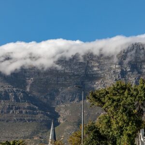
The “tablecloth” is the cloud that pours over the plateau edge like fabric when the south-easter blows. It is beautiful from below and means poor visibility above, and it often coincides with the wind conditions that close the Cableway. San tradition attributes it to Kaggen, the mantis deity; Dutch legend to a smoking contest between the pirate Van Hunks and the devil.
The operator does not publish a recommended time of day, and we will not invent one. What is useful: the Cableway runs a live status feed showing current wind, visibility and waiting times, and that — not a guidebook rule of thumb — is how to decide. Go on the first genuinely clear, still day of your trip rather than saving it for later in the week.
Wildlife and rules
The most visible animal on the mountain is the dassie, or rock hyrax, which sits on the rocks near the Upper Station and is entirely unbothered by people. Do not feed them. SANParks treats feeding or disturbing wildlife as a serious offence, on the grounds that animals which become dependent on humans can turn aggressive and may ultimately have to be destroyed.
Also: do not pick the flowers, do not litter, and note that recreational drones are prohibited anywhere in Table Mountain National Park. Fires are prohibited outside designated fireplaces and may result in a summons.

Nearby
Frequently asked questions
Do I need to book the Cableway in advance?
Buying online is cheaper than the ticket office and saves queueing, and tickets are valid for seven days, which gives useful flexibility. Because closures are weather-driven, do not book for a specific fixed day if you can avoid it.
How hard is it to walk up Table Mountain?
Platteklip Gorge, the standard route, is graded moderate to tough by SANParks and takes one to three hours of continuous steep climbing on steps. It requires reasonable fitness, proper shoes, water and warm windproof clothing. It is not technical, but it is not casual either.
What happens if the Cableway closes while I am at the top?
The operator sounds a hooter at the Upper Station when high winds are approaching, and visitors are expected to return to the station immediately for closure. If you miss the last car down, there is an emergency phone at the Upper Station. Do not plan to walk down in the dark.
Is Table Mountain the same as Cape Point?
No, though both are inside Table Mountain National Park. Cape Point is roughly 60 km south at the tip of the Cape Peninsula, and it is a separate visit with its own gate times and conservation fee. Note also that Cape Agulhas, not Cape Point, is the southernmost point of Africa.
Plan the rest of your trip
The mountain is a half-day to a full day. These pages cover everything around it.
- Table Mountain tours and experiences — cableway tickets, guided half-days and hiking products compared.
- Hiking Table Mountain — what the main routes really involve, the weather, and the mistakes that catch people out.
- Cape Town — the wider city guide, including the areas below the mountain.
- Itineraries — where a mountain morning fits in a three, five or seven-day plan.
- Self-drive guide — driving and parking around Tafelberg Road and the Cape Peninsula.
- Travel planning — seasons, wind, and the weather patterns that decide whether you go up.
- Things to do — other hiking and outdoor days across the Western Cape.
- Accommodation — staying close to the mountain and the City Bowl.
Official sources for Table Mountain
Opening hours, entry fees, permit rules, park closures and seasonal access all change, and we do not republish them here as fixed facts. Before you travel, check the operators and conservation authorities directly:
- Table Mountain Aerial Cableway — live operating status and weather closures.
- Table Mountain National Park (SANParks) — safe hiking guidance, permits and current park notices.
Plan your Cape Town days
Table Mountain works best as a flexible plan inside a longer city stay.
Where to stay, and what to book
Our Cape Town Accommodation accommodation page carries a short orientation to the area and a live availability map. For experiences, see Table Mountain Tours & Experiences.