
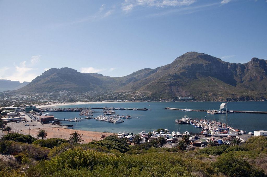
Hero image: South African Tourism from South Africa, CC BY 2.0, via Wikimedia Commons
Hout Bay is usually described as a stop on the way to Chapman’s Peak Drive. That undersells it. It is a real working harbour with a fishing fleet, a mountain-ringed bay with a long beach, a weekend market in a converted fish factory, and the point where the Atlantic coast road turns into one of the great scenic drives. It is also a valley with sharp inequality, and how you visit matters.
Hout Bay sits about twenty minutes south of Camps Bay on the Atlantic Seaboard side of Cape Town, and about fifteen minutes over Constantia Nek from the Southern Suburbs.
What to book in Hout Bay
Kayaking from the harbour, the seal-island boats, and the peninsula tours that come through the bay.
Tours and experiences
Guided Kayaking in Hout Bay, Cape Town
A guided paddle out of Hout Bay harbour under the Sentinel, with the seal island offshore.
View Activity DetailsCape Town: Cape of Good Hope, Seals and Penguins Day Tour
The wildlife-led version of the peninsula day: a seal island boat, the penguin colony and the Cape.
View Tour DetailsCape Peninsula: Cape of Good Hope & Boulders Beach Penguins
The full peninsula circuit — down one coast, back up the other, with the Cape and the penguins in between.
View Tour DetailsTandem Paragliding Flight with the Experts, Cape Town
A pilot-led tandem flight over the city, sold on experience rather than novelty.
View Activity Details

In this guide
- Hout Bay in brief
- The harbour
- Fishing heritage and the people who live here
- The market and eating
- Boat trips and Duiker Island
- The beach and the Sentinel
- Chapman’s Peak Drive
- Walking and the outdoors
- Getting to Hout Bay
- Where to stay in Hout Bay
- Nearby, and what to do next
- Practical notes
- Official sources
Hout Bay in brief
- What it is — a valley suburb of Cape Town built around a working fishing harbour, with its own beach and village centre.
- The setting — a near-enclosed bay guarded by the Sentinel on one side and Chapman’s Peak on the other.
- Best for — harbour atmosphere, fish and chips, a long flat beach walk, boat trips, and the start of Chapman’s Peak Drive.
- Time needed — ninety minutes if you are passing through; half a day if you use the beach and the market.
- Key uncertainty — Chapman’s Peak Drive closes regularly. Always check before you plan a route through it.
The harbour
Hout Bay harbour is not a heritage reconstruction; it is a functioning commercial fishing port, and the difference is obvious the moment you arrive. Trawlers and smaller boats come and go, gear is stacked on the quays, and the smell is fish rather than marketing. Snoek and other catch are sold near the quayside, seals loiter around the moorings hoping for scraps, and the whole thing is far more interesting than a purpose-built waterfront.
Because it is a working port, parts of it are operational rather than public, and access can change. Keep clear of vehicles and loading areas, and treat the fishing crews as people at work rather than as a photo opportunity.
Fishing heritage and the people who live here
The valley’s fishing history is genuinely old, and it is bound up with the communities that still live around the harbour. Hangberg, on the slopes below the Sentinel, is a long-established fishing community; Imizamo Yethu, on the other side of the valley, was established much more recently. Both are ordinary residential neighbourhoods where people live, work and raise children.
They are not attractions. If you want to understand the valley beyond the harbour wall, do it through a locally led walking tour run by residents, book it directly where you can, and follow the guide’s lead on photography. Do not drive through taking pictures of people’s homes, and do not treat poverty as scenery. The Cape Town guide sets out the same principle for the city’s other living communities.
The Hout Bay Museum at 4 Andrews Road covers the valley’s history properly — forestry, mining, the fishing industry, the Khoi people who were here first, and the shipwrecks along this coast. It is a small municipal-scale museum rather than a headline attraction, and opening arrangements are worth confirming directly before making a trip of it.
The market and eating
The Bay Harbour Market occupies an old fish factory beside the harbour and trades on Fridays, Saturdays and Sundays, with food stalls, craft and design traders and live music. It is busiest on Saturday and Sunday afternoons. Trading days and hours do change, so check the market’s own channels before building an evening around it.
Otherwise the eating here is straightforward and good: fish and chips near the harbour, a handful of restaurants along the Main Road, and Mariner’s Wharf on the quay. If you buy fresh fish to cook, ask what came in that day rather than what is on display.
Boat trips and Duiker Island
Short boat trips run from the harbour out to Duiker Island, a rock a few minutes offshore carrying a large Cape fur seal colony. The round trip is usually well under an hour and the boats stand off the island rather than landing. It is a genuinely good short excursion and the only easy way to see the coast from the water here.
Two caveats. Sea conditions cancel trips, and this is an exposed Atlantic bay, so a swell or a strong wind will stop sailings without much notice. And operators, schedules and boarding points vary; book on the day or the day before rather than far ahead, and confirm the meeting point at the harbour.
The beach and the Sentinel
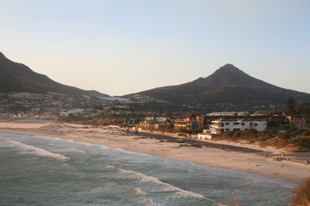
Hout Bay beach is long, flat and backed by dunes, with the Sentinel — the blunt rock tower on the western arm of the bay — dominating the view. It is a walking and dog-walking beach rather than a swimming beach: the water is cold Atlantic, the bay picks up swell, and there is often kelp on the sand. On a still morning it is one of the best flat walks in the city, and it is far quieter than Camps Bay.
Chapman’s Peak Drive
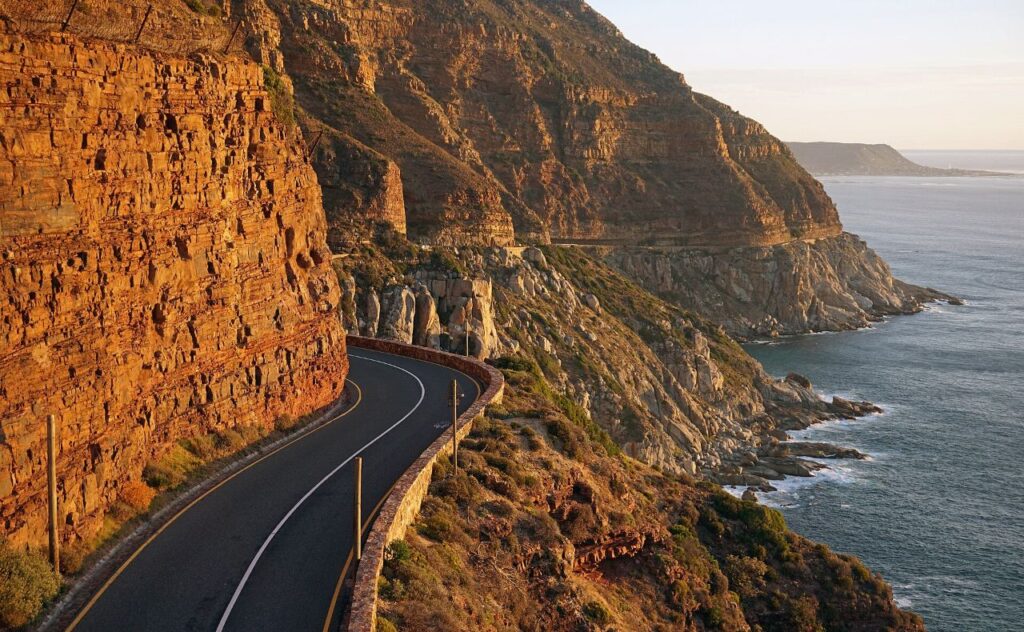
The road that leaves Hout Bay to the south and cuts along the cliff face to Noordhoek is the reason many people come. It is a toll road, cut into the contact between granite and sandstone, with laybys, picnic sites and a sequence of views that get better the further round you go. Driving it slowly, stopping at the viewpoints, takes about half an hour each way.
Do not assume it is open. Chapman’s Peak Drive closes for rockfall, storm damage, fire and maintenance, sometimes at short notice and sometimes for extended periods. Status checked 20 August 2026: the official Chapman’s Peak Drive status page showed the road CLOSED, following the rockfall of 24 April 2026. Closures of this kind have run for months in the past, so treat it as unavailable until the operator says otherwise. Always look at the official status page the morning you intend to drive it, and have the alternative in mind: from Hout Bay the detour to the southern peninsula runs inland over Constantia Nek and down the M3 and Ou Kaapse Weg, which adds a good half hour.
Walking and the outdoors
The valley is ringed by mountains and most of the high ground is inside Table Mountain National Park. Popular routes include the climb up the Chapman’s Peak side for the view back over the bay, the paths behind East Fort above the toll road, and the longer, more exposed walks on the Karbonkelberg above Hangberg.
Standard Cape Peninsula rules apply and they are not decorative: walk in a group, tell someone your route, carry water and a windproof layer, start early, and turn back if the weather closes in. Some routes in this valley have a history of muggings, so ask locally about current conditions rather than relying on an old trail description.
World of Birds in the valley is a large private bird and small-animal sanctuary and a reliable option with children, particularly on a wet day. It is a ticketed commercial attraction; check current opening before travelling.
Getting to Hout Bay
By car — the coastal route from the city runs through Sea Point, Clifton and Camps Bay and over Suikerbossie into the valley, about forty minutes from the city centre without traffic. The inland route comes over Constantia Nek from the Southern Suburbs and is shorter from the M3 side. From the southern peninsula you arrive either along Chapman’s Peak or, when it is closed, over Ou Kaapse Weg.
By bus — MyCiTi routes 108 and 109 link Hout Bay, Hangberg and Imizamo Yethu with Sea Point. Check current timetables before depending on them for a return trip in the evening.
Parking is much easier here than at Camps Bay, with space at the harbour, near the market and along the beachfront. It still fills on market days and over the December holidays.
Where to stay in Hout Bay
Hout Bay is a reasonable base if you want a quieter, more village-feeling address than the city and expect to spend time on the peninsula. It puts Chapman’s Peak, Noordhoek, Kommetjie and the road to Cape Point within easy reach, and Camps Bay and the city are twenty to forty minutes north.
The trade-offs are real: you will drive for almost everything, there is one road in from each direction and they can back up, and the valley’s evening options are limited compared with the city. Accommodation is mostly guesthouses, self-catering apartments and villas, with the quieter addresses spread up the valley slopes and towards the beach.
Find accommodation in Hout Bay
Staying in the valley buys you an early start on the peninsula and a quieter evening than the city. See what is available in and around Hout Bay.
Browse places to stay in Hout BayAffiliate link. We may earn a commission if you book through it, at no additional cost to you. See our affiliate disclosure.
Nearby, and what to do next
- Cape Peninsula tours — guided options for the loop, and the current Chapman’s Peak position.
- Cape Peninsula day trip — where Hout Bay sits on the loop and how long to give it.
- Camps Bay — twenty minutes north along the coast road, for the beach strip and sunset.
- Noordhoek and Long Beach — over Chapman’s Peak, a huge open beach with a village at the far end.
- Cape Point and the Cape of Good Hope — roughly an hour south when Chapman’s Peak is open.
- Constantia — fifteen minutes over Constantia Nek, for the wine estates and Kirstenbosch.
- Simon’s Town — about forty-five minutes across the peninsula on the False Bay side.
- Atlantic Seaboard overview — how the coast fits together from Green Point to Llandudno.
Featured activities from Hout Bay
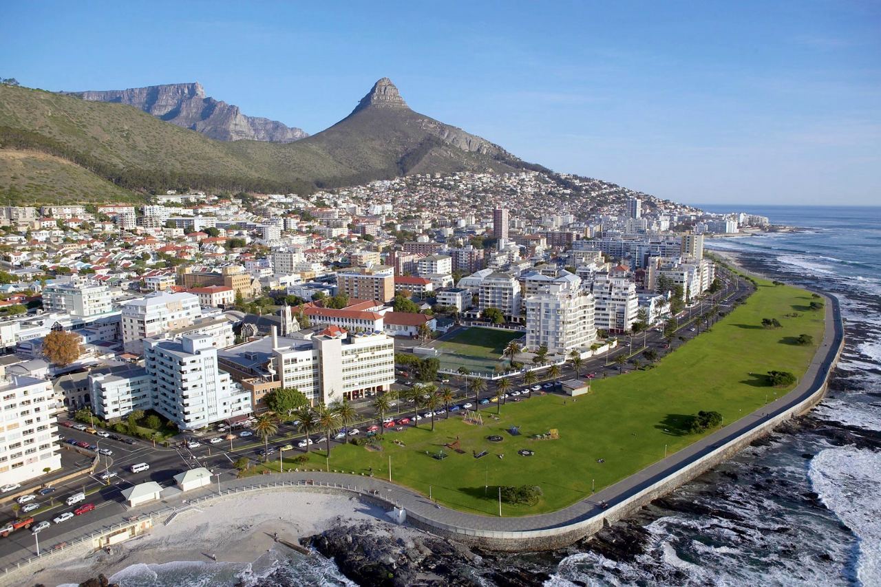
Hout Bay is the more dramatic of Cape Town’s two sea-kayak launches, with the Sentinel above the bay and the Duiker Island seal colony offshore. These pages explain the conditions and what to check before booking.

Practical notes
- Check Chapman’s Peak first — before committing to any route that uses it.
- Baboons — troops move through parts of the valley. Never feed them, keep car windows closed when parked, and do not leave food visible.
- Seals — the animals around the harbour are wild. Keep your distance; they bite.
- Valuables — leave nothing visible in a parked car, at the harbour or at the beach.
- Weather — the bay funnels wind. A calm city can mean a blustery beach here, and the reverse.
Official sources
- Chapman’s Peak Drive — official live open or closed status and toll tariffs.
- SANParks — Table Mountain National Park — trails, permits and park notices for the mountains around the valley.
- Hout Bay Museum — the valley’s own museum.
- MyCiTi — current routes and timetables for routes 108 and 109.
- Cape Town Tourism — current destination information.
Where to stay, and what to book
Our Hout Bay accommodation page carries a short orientation to the area and a live availability map. For experiences, see Cape Peninsula Tours.