
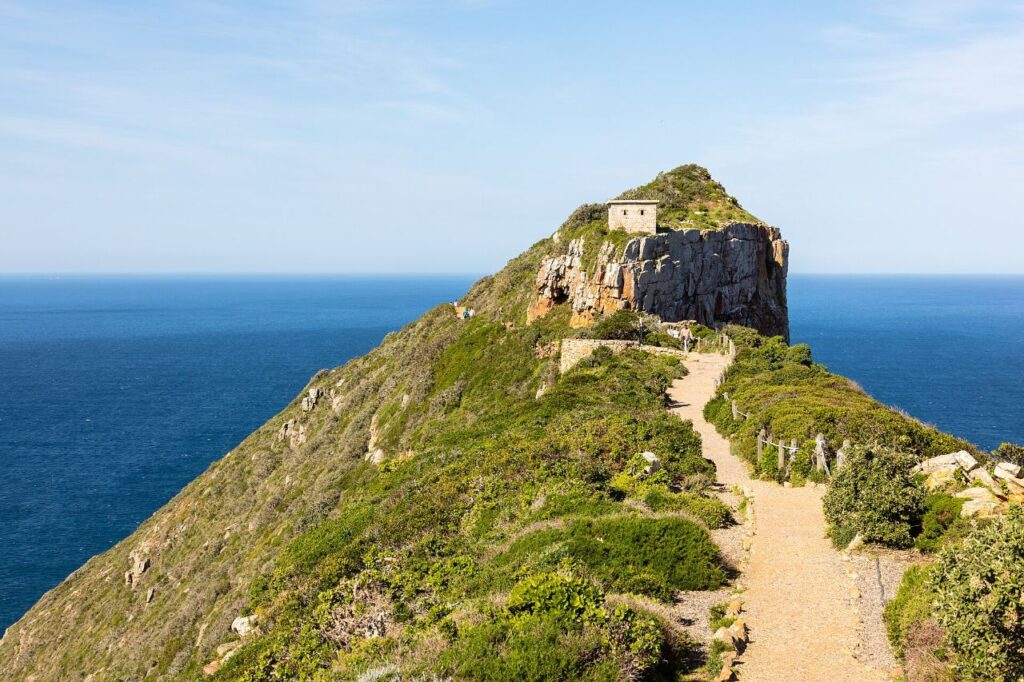
Hero image: Diego Delso, CC BY-SA 4.0, via Wikimedia Commons
Cape Point and the Cape of Good Hope are not the same place, and neither of them is where the Atlantic and Indian Oceans meet. Both statements get made constantly, on tour buses and in guidebooks, and getting them straight makes the visit better rather than worse. This page explains what is actually there, how to get in, when to go, and what the landscape is doing.
Both headlands lie inside the Cape of Good Hope section of Table Mountain National Park, at the southern end of the Cape Peninsula, about an hour and a quarter from central Cape Town and twenty-five minutes beyond Simon’s Town.
What to book for Cape Point
Guided days to the Cape of Good Hope, run from Cape Town, that handle the driving and the reserve gate.
Tours and experiences
From Cape Town: Cape Point & Boulders Beach Full-Day Tour
The unhurried version of the peninsula circuit, with time at the Cape rather than a photograph and a departure.
View Tour DetailsCape Peninsula: Cape of Good Hope & Boulders Beach Penguins
The full peninsula circuit — down one coast, back up the other, with the Cape and the penguins in between.
View Tour DetailsCape Town: Private Full-Day Cape of Good Hope Tour
The peninsula at your own pace, with the itinerary and the stops decided by you rather than a schedule.
View Tour DetailsFrom Cape Town: Cape Point and Boulders Beach Half-Day Tour
The compressed version of the classic peninsula run: the penguin colony and the Cape itself, back in the city by…
View Tour Details


In this guide
- Cape Point in brief
- Cape Point or the Cape of Good Hope? The difference
- Where the two oceans actually meet
- Getting in: gates, fees and payment
- The funicular, the lighthouses and the walk up
- Walking, beaches and the coast
- Wildlife, and the baboon problem
- Weather, wind and closures
- Timing your visit
- Where to stay for Cape Point
- Nearby, and what to do next
- Official sources
Cape Point in brief
- What it is — a section of Table Mountain National Park covering roughly the last stretch of the Cape Peninsula, including two famous headlands.
- Cape Point — the high rocky headland with the old and new lighthouses, the funicular and the visitor facilities.
- Cape of Good Hope — a lower promontory about two kilometres to the south-west, with the well-known signboard and cliff walks.
- Entry — a SANParks conservation fee at the gate; card payment only, no cash.
- Time needed — three hours inside the gate is a comfortable minimum; a full day if you walk.
- The wind — this is one of the windiest places you will stand in South Africa. Dress for it.
Cape Point or the Cape of Good Hope? The difference
Cape Point is the dramatic one. It is a narrow, high headland on the eastern side of the peninsula’s tip, and the whole visitor infrastructure is there: the car park, the shops and restaurant, the Flying Dutchman funicular, and the path up to the old lighthouse on the summit with its long views down the cliffs. If someone shows you a photograph of a lighthouse on a knife-edge ridge above the sea, that is Cape Point.
The Cape of Good Hope is the quieter one. It is a lower, broader rocky promontory about two kilometres to the south-west, reached by its own road and car park, and it is where the signboard stands announcing the most south-western point of the African continent. There is no funicular and no restaurant — just rock, surf, fynbos and a short cliff walk. Many visitors photograph the sign and leave; walking a little way along the cliffs from there is the better part.
They are ten minutes apart by car inside the park, and the honest answer is to do both. If you only have time for one, Cape Point has the view and the Cape of Good Hope has the atmosphere.

Where the two oceans actually meet
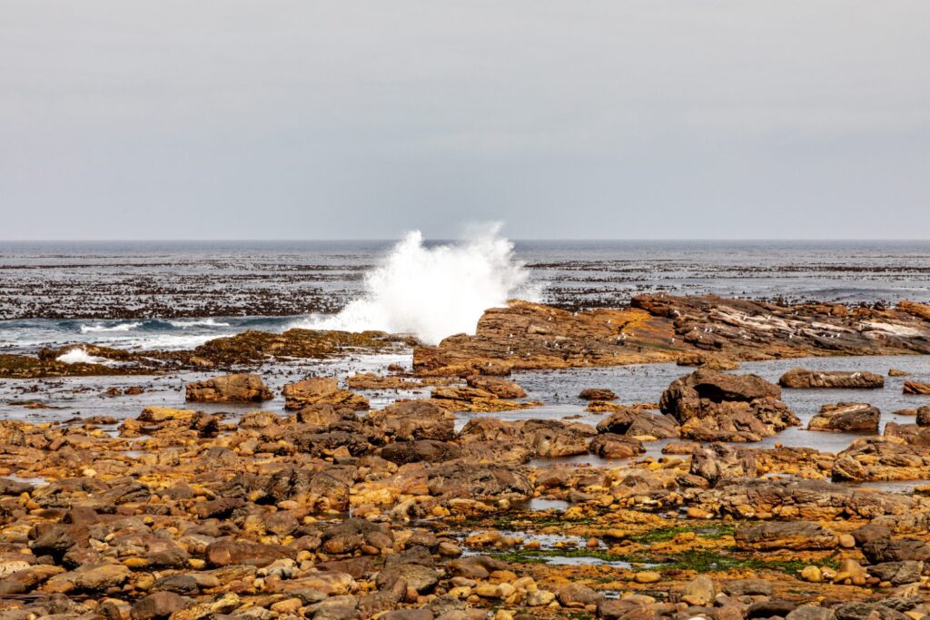
You will be told, repeatedly, that this is the meeting point of the Atlantic and Indian Oceans. It is not, and the real answer is more interesting.
The conventional dividing line between the two oceans is drawn at Cape Agulhas, about 150 kilometres to the south-east, which is the geographic southern tip of Africa and roughly 55 kilometres further south than the Cape of Good Hope. That is the line recognised by the International Hydrographic Organization, and it is why the Cape Overberg rather than the Cape Peninsula holds the marker.
Physically, though, there is no line at all. What exists is a wide and constantly moving frontal zone where the warm Agulhas Current, running south down Africa’s east coast, turns back on itself — the Agulhas retroflection — and pinches off enormous eddies that carry heat and salt into the South Atlantic. Meanwhile the cold Benguela system runs up the west coast. The boundary between the two water masses shifts with season and conditions, sometimes by hundreds of kilometres.
So the accurate version is this: Cape Point is the south-western corner of Africa, not its southern tip; it sits close to a genuinely important oceanographic transition; and the temperature difference you can feel between the peninsula’s two coasts is real. The tidy line on the souvenir map is not.
Getting in: gates, fees and payment
Entry is through the park gate on the road south from Simon’s Town and Scarborough. Official entry times vary by season, with all visitors required to be out by sunset:
- October to March — entry from 06:00 to 18:00.
- April to September — entry from 07:00 to 17:00.
A SANParks conservation fee is charged per person. Under the tariff valid from 1 November 2025 to 31 October 2026, the Cape Point rate is R110 for South African citizens and residents, R225 for SADC nationals and R515 for international visitors, with reduced rates for children aged 2 to 11. The gates are cash-free and take card payment only. Tariffs are reviewed annually, so check the current schedule before you travel.
If you also plan to visit Boulders, or you are in the Western Cape for a while and will use several national parks, it is worth comparing the cost of a SANParks Wild Card against individual entries. Note that neighbouring reserves run by CapeNature or municipalities are separate systems and are not covered by it.
The funicular, the lighthouses and the walk up
From the Cape Point car park you reach the old lighthouse either on foot up a paved but steep path, or on the Flying Dutchman funicular, a short hill railway operated by the Cape Point Partnership under concession. The funicular is ticketed separately from park entry, and there are still steps at the top.
The old lighthouse, high on the summit, turned out to be the wrong idea: it sits so high that it is frequently lost in cloud, and ships kept failing to see it. A lower new lighthouse was built further down and out on the point, and it is the one still in service. You can see it from the viewing platforms; the walk out along the ridge towards it is exposed and should not be attempted in strong wind.
Walking up instead of riding takes fifteen to twenty-five minutes at an ordinary pace and is entirely manageable for most people. Going up on foot and taking the funicular down is a reasonable compromise if the queue is long on arrival.
Walking, beaches and the coast
The section is far bigger than its two headlands and most of it is empty. Some of what is there:
- Cape of Good Hope cliff walks — short routes from the signboard car park along the rocks and up towards the ridge.
- Olifantsbos shipwreck trail — a coastal walk on the Atlantic side to wreck remains. Exposed, no shade, no services; carry water.
- Buffelsfontein — the visitor centre, and the practical place to ask about current conditions and route closures.
- Buffels Bay — a sheltered picnic area and tidal pool on the False Bay side, and the best place in the park for a swim.
- Diaz Beach — spectacular, reached down a long stairway, and closed to swimming. There are strong rip currents and no lifeguards anywhere in the section.
- The Cape of Good Hope hiking trail — a longer overnight route through the section, booked separately through SANParks.
None of the beaches here are patrolled. Treat all water in the section as unsafe for swimming unless it is an enclosed tidal pool.
Wildlife, and the baboon problem
The section is a fynbos landscape with large mammals in it: eland, bontebok, Cape mountain zebra and ostrich are all seen from the roads, and the smaller things — sunbirds, tortoises, dassies — are more common than the big ones. In winter and spring, southern right whales are regularly visible from the False Bay side.
The chacma baboons are the one serious visitor issue. Troops in this part of the peninsula have learned that people carry food, and they will take it — from a picnic table, from a bag, from your hand, and out of an open car window. They are large, fast and strong, and an animal that becomes food-conditioned usually ends up being destroyed.
- Keep all car windows and doors closed when parked, and the boot shut.
- Do not eat outdoors in the car parks or at viewpoints where baboons are present.
- Never feed them, never offer food to get a photograph, and do not stand between an animal and its escape route.
- If a baboon approaches, do not run, do not shout at it and do not try to hold on to a bag it is pulling at. Let it go.
- Report problem behaviour to park staff rather than dealing with it yourself.
Weather, wind and closures
The tip of the peninsula makes its own weather and it changes fast. A clear morning in the city can be fog, drizzle or a 60 km/h wind by the time you reach the gate. Take a windproof layer whatever the forecast says, and take it in summer too.
The section closes, or parts of it close, for fire, storm damage, road repairs and management operations. Fire in particular can shut roads and trails at short notice in the dry summer months. Check SANParks notices before you set out, and accept redirection from staff without argument — this is a fynbos landscape where fires move very quickly.
Timing your visit
Cape Point receives a heavy midday load of coach tours, and between roughly 11:00 and 14:00 the funicular queue, the car park and the restaurant are all at their worst. Two ways round it:
- Arrive at opening. First light on the cliffs is the best of it, the animals are more active, and you will have the Cape of Good Hope car park close to yourself.
- Arrive after 15:00. The tours have gone, the light is better, and the wind often eases. Watch the closing time carefully, and remember you must be out by sunset.
Allow more time than you expect. The drive from the gate to Cape Point alone takes fifteen minutes, and doing both headlands properly with a short walk at each is a three to four hour commitment inside the park.
Where to stay for Cape Point
There is no ordinary visitor accommodation inside the Cape of Good Hope section, which is deliberate. If you want to be at the gate when it opens, stay in Simon’s Town, twenty-five minutes away and the most practical base, or in one of the smaller southern peninsula villages such as Kommetjie, Scarborough or Noordhoek. From the city centre it is an hour and a quarter each way, which makes an early start hard work.
Nearby, and what to do next
- Cape Peninsula tours — which guided format reaches Cape Point on the day you want.
- Cape Peninsula day trip — how to fit Cape Point into a single day without rushing it.
- Simon’s Town and the penguin colony at Boulders — twenty-five minutes north, and the obvious pairing.
- Hout Bay and Chapman’s Peak Drive — the Atlantic side of the return loop, when the road is open.
- Kommetjie and Scarborough — small coastal villages on the road north-west from the gate.
- False Bay and the Southern Peninsula — the wider cluster this belongs to.
- Table Mountain — the northern end of the same protected mountain chain.
- 5-day Cape Town itinerary — where the peninsula day fits in a full trip.
Official sources
- SANParks — Table Mountain National Park — conservation fees, park rules, trails and current notices.
- SANParks conservation tariffs — the current fee schedule and its validity dates.
- Cape Point — the concession operator, for entry times, the funicular and on-site facilities.
- Chapman’s Peak Drive — live status, if you are looping back that way.
- UNESCO — Cape Floral Region Protected Areas — the World Heritage listing this landscape forms part of.
Where to stay, and what to book
Our False Bay & Southern Peninsula accommodation page carries a short orientation to the area and a live availability map. For experiences, see Cape Peninsula Tours.